Sunday, July 5th dawned with a headache and a belly full of patriotic, red-dye sausages earned from an evening of aggressively celebrating our country's independence in Errol, NH. The best remedy for gluttony is often simply a different kind of gluttony; I needed a purge in the mountains, a reset of body and mind. So with the cloud ceiling concealing just the very tips of the northern Presidentials, I thought conditions decent enough to flail up Adams in an effort to regain homeostasis.
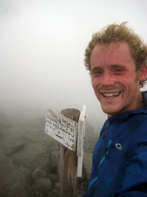
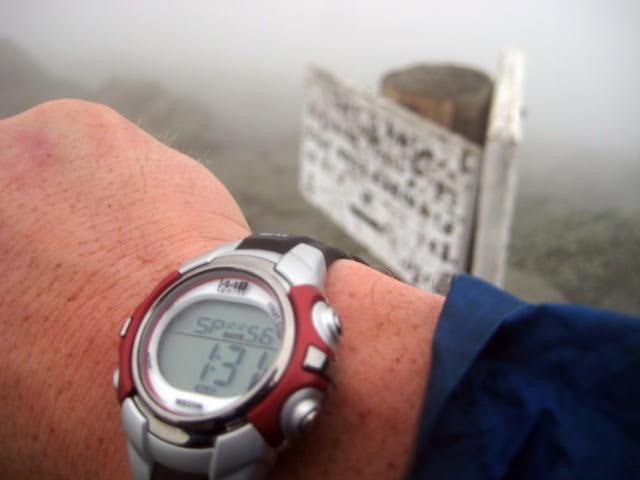
Somewhere in the ballpark of 1 PM I began with a hand on the kiosk, hit start on the watch and went scuttling up Valley Way. I'm still a member of the dumbphone generation and I can't afford a GPS watch, so the little wristwatch purchased recently from Pinkham Notch was to be my only mode of verification. Following the prescribed route (which I had scouted a few days prior with a friend), I found myself at Air Line in 53 minutes and feeling good about finishing in a quick time. Climbing steadily up the knife edge ridge, I punched into the clouds and wind around the level of the Air Line Cutoff. Gulfside and Lowe's went by in a foggy haze, with characteristic one-cairn visibility, and I topped out in a total time of 1:31:56.
After snapping the summit photos, I promptly paid no attention to where I was going and accidentally descended the Star Lake trail. A leisurely trip down some small connector trails that I hadn't covered before (Air Line Cutoff, Upper and Lower Bruin, and the Scar Loop) deposited me back at Appalachia, too late to go the White Mountain Cafe. Another day!
Ever since hearing of this challenge and seeing the names and times of friends on the results page, I eagerly wanted to see how I stacked up to the route and mountain. The Brookside - Watson - Scar linkup is a stellar combo of trails, all with the lovely feeling of obscurity that comes from any trail that doesn't lead immediately to a hut or 4000-footer. Thanks for putting this together, and thanks to all who maintain this land and these trails.